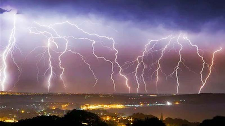
Over 13,000 Lightning Strikes Hit UK Amid Severe Thunderstorms

Severe weather warnings for rain across most of England and Wales on Sunday and Monday are marking an abrupt end to summer, with intense thunderstorms sweeping across the UK. By Sunday morning, meteorologists reported over 13,000 lightning strikes across the UK, signalling the end of a brief summer spell.
Forecasters have urged the public to stay cautious of local flooding, with the possibility of some communities being cut off by flooded roads and a risk of power outages.
Three roads in Northampton were closed on Sunday, and cars were stranded due to surface water flooding, which also led to the postponement of several events, including a charity cycle ride and the Sywell Classic car and air show.
Thousands of households faced power cuts over the weekend in areas such as Tewkesbury in Gloucestershire and parts of North and West Yorkshire.
A tornado caused property damage and felled trees in the Hampshire town of Aldershot on Saturday, with footage captured by a Ring doorbell.
Fire crews attended homes in Telford and Stoke-on-Trent that were struck by lightning, with one incident in Stoke dramatically captured on a home security camera.
Residents in the town of Longton, Stoke, were evacuated. One resident told the press, “We had just returned home. It was around 5:30 pm when we heard a massive bang. A car stopped outside, and the driver shouted that the roof was on fire. I think about four homes, including ours, were evacuated. We’ve all gathered at one of our neighbours' houses.”
On Sunday, the autumn equinox – when day and night are nearly equal in length – warm, humid weather in Wales and southern England will continue, interspersed with thunderstorms.
Residents in the southeast may be woken by thunderstorms overnight into Monday, which will move northward, with the heaviest downpours expected across the Midlands, before reaching northern and southwestern England.
More thunderstorms are expected on Monday, along with an amber weather warning stretching from the West Midlands through South Yorkshire to the East Yorkshire coast. Parts of these areas could experience between 100 and 120mm of rain. The weather is expected to clear in the southeast of England.
A yellow warning is also in place for most of England and Wales on Monday, except for the western parts of Wales and southwest England. Northern and northeastern England, as well as parts of Scotland, are expected to remain mostly cloudy with light rain, according to the Met Office.
Later in the week, the equilux – when day and night are exactly the same length – will occur on Tuesday. By then, the storms will have subsided, leaving wet and windy conditions from Wednesday onwards. Friday is expected to feel more autumnal as Arctic air lowers temperatures to 11-12°C, below the seasonal average.
Met Office meteorologist Jonathan Vautrey said: “With Sunday marking the autumnal equinox, summer has officially come to an end, and it ended with a bang for some of us.”
He added, “We have a rain warning in effect throughout Sunday for this band of rain moving across Wales and central southern areas of England. Some very heavy pulses are possible, leading to surface water issues and travel disruptions, so it’s worth being cautious if you’re out and about or travelling during the day.”
 (5).png)


